No Image Lot 896 SOMERSET C.C.C. Over 110 home and away scorecards, 82 from the 1950's including v Australia 1953 and 896SOMERSET C.C.C. Over 110 home and away scorecards, 82 from the 1950's including v Australia 1953 and Sportingold Limited SOMERSET C.C.C. Over 110 home and away scorecards, 82 from the 1950's including v Australia 1953 and 1956, Pakistan 1954, India 1959, West I... Live
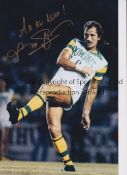
No Image Lot 1266 FRANK WORTHINGTON Autographed 12 x 8 col photo of Worthington in full length action for the Tampa 1266FRANK WORTHINGTON Autographed 12 x 8 col photo of Worthington in full length action for the Tampa Sportingold Limited FRANK WORTHINGTON Autographed 12 x 8 col photo of Worthington in full length action for the Tampa Bay Rowdies, c1981, signed All The Best in ... Live
No Image Lot 480 ONE BOX OF VINTAGE MAPS AND ATLASES, to include a distressed leather case containing a set of G.W 480ONE BOX OF VINTAGE MAPS AND ATLASES, to include a distressed leather case containing a set of G.W Richard Winterton Auctioneers ONE BOX OF VINTAGE MAPS AND ATLASES, to include a distressed leather case containing a set of G.W Bacon & Co. Ltd new half inch 'Cycling Road Maps... Add to watchlist Live
No Image Lot 833 Six 19th and 20th century folding maps of Sussex; an Ordnance Survey (318), a W.H. Smith & Son 833Six 19th and 20th century folding maps of Sussex; an Ordnance Survey (318), a W.H. Smith & Son Gorringes Six 19th and 20th century folding maps of Sussex; an Ordnance Survey (318), a W.H. Smith & Son map, a Smith & Son 172 Strand 1864, two Walker’s Co... Add to watchlist Live
No Image Lot 834 Three unframed 17th century maps of Sussex; Richard Blome, 31 x 35cm, Robert Morden, 38 x 44cm and 834Three unframed 17th century maps of Sussex; Richard Blome, 31 x 35cm, Robert Morden, 38 x 44cm and Gorringes Three unframed 17th century maps of Sussex; Richard Blome, 31 x 35cm, Robert Morden, 38 x 44cm and Johannes Blaeu, 42 x 56cm***CONDITION REPORT***... Add to watchlist Live
No Image Lot 835 Three unframed 17th century maps of Sussex; a Norden and Kip map, 25 x 41cm, a John Speed, 41 x 54cm 835Three unframed 17th century maps of Sussex; a Norden and Kip map, 25 x 41cm, a John Speed, 41 x 54cm Gorringes Three unframed 17th century maps of Sussex; a Norden and Kip map, 25 x 41cm, a John Speed, 41 x 54cm and a John Overton, 37 x 54cm***CONDITION REP... Add to watchlist Live
No Image Lot 838 Four unframed 17th century maps of Sussex; two by Robert Morden, 39 x 43cm and 37 x 43cm, Norden & 838Four unframed 17th century maps of Sussex; two by Robert Morden, 39 x 43cm and 37 x 43cm, Norden & Gorringes Four unframed 17th century maps of Sussex; two by Robert Morden, 39 x 43cm and 37 x 43cm, Norden & Kip 28 x 42cm, and Valk & Schenk, 49 x 59cm***C... Add to watchlist Live
No Image Lot 839 Three unframed 17th century maps of Sussex; Jan Jansson, 40 x 53cm, Robert Morden, 37 x 43cm and 839Three unframed 17th century maps of Sussex; Jan Jansson, 40 x 53cm, Robert Morden, 37 x 43cm and Gorringes Three unframed 17th century maps of Sussex; Jan Jansson, 40 x 53cm, Robert Morden, 37 x 43cm and Norden & Kip, 29 x 45cm***CONDITION REPORT***PLEA... Add to watchlist Live
No Image Lot 840 Eight framed 18th and 19th century maps of Sussex, etc., including maps by; Langley, Eman Bowen, 840Eight framed 18th and 19th century maps of Sussex, etc., including maps by; Langley, Eman Bowen, Gorringes Eight framed 18th and 19th century maps of Sussex, etc., including maps by; Langley, Eman Bowen, Cary, etc. largest 22 x 27cm***CONDITION REPORT**... Add to watchlist Live
No Image Lot 847 Five framed maps of Sussex, including four 18th century examples by Herman Moll, Johanes Norden, 847Five framed maps of Sussex, including four 18th century examples by Herman Moll, Johanes Norden, Gorringes Five framed maps of Sussex, including four 18th century examples by Herman Moll, Johanes Norden, etc. largest 49 x 62cm***CONDITION REPORT***PLEAS... Add to watchlist Live
No Image Lot 848 John Speed (1552-1629), mid 17th century hand coloured map of Hartfordshire, 39 x 52cm, text 848John Speed (1552-1629), mid 17th century hand coloured map of Hartfordshire, 39 x 52cm, text Gorringes John Speed (1552-1629), mid 17th century hand coloured map of Hartfordshire, 39 x 52cm, text verso, sold by Thomas Bassett and Richard Chiswell***... Add to watchlist Live
No Image Lot 31 Ordnance Survey maps, the Port of London Authority plan of the India and Millwall dock, 1959, f/g 31Ordnance Survey maps, the Port of London Authority plan of the India and Millwall dock, 1959, f/g Keys Fine Art Auctioneers Ordnance Survey maps, the Port of London Authority plan of the India and Millwall dock, 1959, f/g Add to watchlist Live
No Image Lot 115 Gaskill & Chambers Ltd patent ale utiliser 115Gaskill & Chambers Ltd patent ale utiliser Keys Fine Art Auctioneers Gaskill & Chambers Ltd patent ale utiliser Add to watchlist Live
No Image Lot 198 Two boxes of assorted books to include The Great Rock Discography, William Blake, Ordinance Survey 198Two boxes of assorted books to include The Great Rock Discography, William Blake, Ordinance Survey Paul Beighton Auctioneers Ltd. Two boxes of assorted books to include The Great Rock Discography, William Blake, Ordinance Survey Maps, Byron, etc. Add to watchlist Live
No Image Lot 227 A quantity of various prints, maps etc. 227A quantity of various prints, maps etc. Clarke and Simpson Auctions A quantity of various prints, maps etc. Add to watchlist Live
No Image Lot 339 Robert Morden, hand coloured map of Scotland 339Robert Morden, hand coloured map of Scotland Clarke and Simpson Auctions Robert Morden, hand coloured map of Scotland Add to watchlist Live
No Image Lot 411 A collection of mostly cricketing prints and montages, some signed, along with a 1932 Ordnance 411A collection of mostly cricketing prints and montages, some signed, along with a 1932 Ordnance Paul Beighton Auctioneers Ltd. A collection of mostly cricketing prints and montages, some signed, along with a 1932 Ordnance Survey map of Yorkshire. To include The Birth of Th... Add to watchlist Live
No Image Lot 656 A large quantity of colouring pencils 656A large quantity of colouring pencils Clarke and Simpson Auctions A large quantity of colouring pencils Add to watchlist Live
No Image Lot 664 A large quantity of colouring pencils 664A large quantity of colouring pencils Clarke and Simpson Auctions A large quantity of colouring pencils Add to watchlist Live
No Image Lot 665 A large quantity of colouring pencils 665A large quantity of colouring pencils Clarke and Simpson Auctions A large quantity of colouring pencils Add to watchlist Live
No Image Lot 666 A large quantity of colouring pencils 666A large quantity of colouring pencils Clarke and Simpson Auctions A large quantity of colouring pencils Add to watchlist Live
No Image Lot 667 A large quantity of colouring pencils 667A large quantity of colouring pencils Clarke and Simpson Auctions A large quantity of colouring pencils Add to watchlist Live
No Image Lot 787 A coloured map "Approaches to Felixstowe, Harwich 787A coloured map "Approaches to Felixstowe, Harwich Clarke and Simpson Auctions A coloured map "Approaches to Felixstowe, Harwich and Ipswich With The River Stour, Orwell and Deben" and a copper print map of Somerset Add to watchlist Live
No Image Lot 828 Two boxes containing various reference books, maps 828Two boxes containing various reference books, maps Clarke and Simpson Auctions Two boxes containing various reference books, maps etc. Add to watchlist Live
No Image Lot 861 A collection of unframed maps 861A collection of unframed maps Clarke and Simpson Auctions A collection of unframed maps Add to watchlist Live
No Image Lot 998 A quantity of unframed maps and sketches 998A quantity of unframed maps and sketches Clarke and Simpson Auctions A quantity of unframed maps and sketches Add to watchlist Live
No Image Lot 551 Study of a dog, village scene and framed map (3) 551Study of a dog, village scene and framed map (3) Keys Fine Art Auctioneers Study of a dog, village scene and framed map (3) Add to watchlist Live
No Image Lot 619 Books - catalogue of manuscript maps and topographical drawings and others 619Books - catalogue of manuscript maps and topographical drawings and others Keys Fine Art Auctioneers Books - catalogue of manuscript maps and topographical drawings and others Add to watchlist Live
No Image Lot 226 TWO FRAMED US MEDAL EXAMPLES 226TWO FRAMED US MEDAL EXAMPLES Southgate Auction Rooms TWO FRAMED US MEDAL EXAMPLES Add to watchlist Live
No Image Lot 227 DUTCH FROZEN RIVER PRINT 110CM X 90CM - BAREND KOEKKOEK 227DUTCH FROZEN RIVER PRINT 110CM X 90CM - BAREND KOEKKOEK Southgate Auction Rooms DUTCH FROZEN RIVER PRINT 110CM X 90CM - BAREND KOEKKOEK Add to watchlist Live
Reserve not met No Image Lot 119 After John Speed (1552-1629), a 19th century hand coloured engraved map of Cumberland, framed and 119After John Speed (1552-1629), a 19th century hand coloured engraved map of Cumberland, framed and Criterion Auctioneers Ltd After John Speed (1552-1629), a 19th century hand coloured engraved map of Cumberland, framed and glazed. H.43 W.55cm. Add to watchlist Timed
Reserve not met No Image Lot 136 SEVEN CONIC PROJECTION MAPS T/W BRITISH EMPIRE MAPS 136SEVEN CONIC PROJECTION MAPS T/W BRITISH EMPIRE MAPS Auctioneum Ltd - East Bristol & Bath A collection of seven 20th century Conic Projection maps together with another. The lot to include: the map of Iran (Persia) scale 1:4,000,000 pla... Add to watchlist Timed
No Image Lot 48 Collection of Ordnance Survey maps, GNER china and railwayana, glasswares including decanter, 48Collection of Ordnance Survey maps, GNER china and railwayana, glasswares including decanter, Thomas Watson Collection of Ordnance Survey maps, GNER china and railwayana, glasswares including decanter, part tea sets, decorative porcelain, etc. Add to watchlist Live
No Image Lot 163 A group of bathymetrical surveys of the Freshwater Lochs of Scotland, 163A group of bathymetrical surveys of the Freshwater Lochs of Scotland, Thomas N. Miller A group of bathymetrical surveys of the Freshwater Lochs of Scotland, published by the Royal Geographical Society. (1 box) Add to watchlist Live
No Image Lot 201 A Framed Australian Print of a River by Arthur Streeton, "The Purple Noon's Transparent Light", 53cm 201A Framed Australian Print of a River by Arthur Streeton, "The Purple Noon's Transparent Light", 53cm Brettells Auctioneers & Valuers A Framed Australian Print of a River by Arthur Streeton, "The Purple Noon's Transparent Light", 53cm Square Add to watchlist Live
No Image Lot 246 A late-17th/early 18th-century hand-coloured and engraved map of Northumberland by Robert Morden, 246A late-17th/early 18th-century hand-coloured and engraved map of Northumberland by Robert Morden, Thomas N. Miller A late-17th/early 18th-century hand-coloured and engraved map of Northumberland by Robert Morden, 43cm x 36cm, together with a further Robert Mord... Add to watchlist Live
No Image Lot 248 An early 17th-century Dutch hand-coloured and engraved map of Northumberland, Cumbria and Durham, 248An early 17th-century Dutch hand-coloured and engraved map of Northumberland, Cumbria and Durham, Thomas N. Miller An early 17th-century Dutch hand-coloured and engraved map of Northumberland, Cumbria and Durham, published Amsterdam 1607, 14cm x 19cm, together ... Add to watchlist Live
No Image Lot 315 After George Taylor (1760 - 1788) The Road from Elvanfoot to Dumfries Antique hand-coloured plate 315After George Taylor (1760 - 1788) The Road from Elvanfoot to Dumfries Antique hand-coloured plate Thomson Roddick Auctioneers & Valuers After George Taylor (1760 - 1788) The Road from Elvanfoot to Dumfries Antique hand-coloured plate map, to reverse 'The Road from Glasgow to Longto... Add to watchlist Live
No Image Lot 326 Edward Stanford, City of Victoria Vancouver Island water-colour tinted engraved map, dissected and 326Edward Stanford, City of Victoria Vancouver Island water-colour tinted engraved map, dissected and Griffin's Auctioneers and Valuers Edward Stanford, City of Victoria Vancouver Island water-colour tinted engraved map, dissected and laid of cotton, cloth covered boards with prin... Add to watchlist Live
No Image Lot 327 Pieter van den Keere for John Speed, three hand coloured engraved miniature maps from Speed’s 327Pieter van den Keere for John Speed, three hand coloured engraved miniature maps from Speed’s Griffin's Auctioneers and Valuers Pieter van den Keere for John Speed, three hand coloured engraved miniature maps from Speed’s Epitome; to include; Tartaria, China & The Turkish E... Add to watchlist Live
No Image Lot 328 Warwickshire, three antique framed maps of Warwickshire, including; Bowen & Owen Warwickshire, 328Warwickshire, three antique framed maps of Warwickshire, including; Bowen & Owen Warwickshire, Griffin's Auctioneers and Valuers Warwickshire, three antique framed maps of Warwickshire, including; Bowen & Owen Warwickshire, Warwickshire by Christopher Saxton from Camden’s Br... Add to watchlist Live
No Image Lot 328a W Peacock Superior Dissected Map of England and Wales in pictorial wooden box 328aW Peacock Superior Dissected Map of England and Wales in pictorial wooden box Griffin's Auctioneers and Valuers W Peacock Superior Dissected Map of England and Wales in pictorial wooden box: The map is Gall & Inglis' England and Wales, which is colored by co... Add to watchlist Live
No Image Lot 347 Select Views in the County of Lincoln engraved by Bartholomew Howlett. [Printed by W. Bulmer & Co, 347Select Views in the County of Lincoln engraved by Bartholomew Howlett. [Printed by W. Bulmer & Co, Griffin's Auctioneers and Valuers Select Views in the County of Lincoln engraved by Bartholomew Howlett. [Printed by W. Bulmer & Co, London, 1802]. XIII, XIV & three others. (5) Add to watchlist Live
No Image Lot 426 A Cast Metal Britannia Pub Table, 58cm Diameter 426A Cast Metal Britannia Pub Table, 58cm Diameter Brettells Auctioneers & Valuers A Cast Metal Britannia Pub Table, 58cm Diameter Add to watchlist Live
No Image Lot 526 An early 19th century engraved and hand coloured map of Newcastle upon Tyne & Gateshead, 526An early 19th century engraved and hand coloured map of Newcastle upon Tyne & Gateshead, Thomas N. Miller An early 19th century engraved and hand coloured map of Newcastle upon Tyne & Gateshead, published 1808, 18 cm x 23 cm together with three later m... Add to watchlist Live
No Image Lot 582 HARRY MARGARY & PHILLIMORE CO LTD '250 YEARS OF MAP MAKING' 582HARRY MARGARY & PHILLIMORE CO LTD '250 YEARS OF MAP MAKING' Duke's Avenue Auctions HARRY MARGARY & PHILLIMORE CO LTD '250 YEARS OF MAP MAKING' county of Sussex, complete and Great Wishford ordnance survey maps, 1941 Add to watchlist Live
No Image Lot 583 EMAN. BOWEN: ACCURATE MAP OF DEVONSHIRE divided into Hundreds 583EMAN. BOWEN: ACCURATE MAP OF DEVONSHIRE divided into Hundreds Duke's Avenue Auctions EMAN. BOWEN: ACCURATE MAP OF DEVONSHIRE divided into Hundreds (rolled, torn), and a collection of various unframed maps, including Dorset maps, on... Add to watchlist Live
No Image Lot 584 EMAN. BOWEN: 'AN ACCURATE MAP OF THE COUNTY OF SURREY' 584EMAN. BOWEN: 'AN ACCURATE MAP OF THE COUNTY OF SURREY' Duke's Avenue Auctions EMAN. BOWEN: 'AN ACCURATE MAP OF THE COUNTY OF SURREY' coloured, with C.Smith, 'A New Map of the County of Surrey', both framed (2) (some damage a... Add to watchlist Live
No Image Lot 641 A COLLECTION OF PRINTS, ETCHING AND MAPS 641A COLLECTION OF PRINTS, ETCHING AND MAPS Duke's Avenue Auctions A COLLECTION OF PRINTS, ETCHING AND MAPS Add to watchlist Live
No Image Lot 652 ANTHONY BROWN 652ANTHONY BROWN Duke's Avenue Auctions ANTHONY BROWN Kimmeridge, collage, 55 x 42cm, with Bunty Mabley, Standing Stones and other collages, and a print of City of London School and two ... Add to watchlist Live
No Image Lot 666 JEFF SUDDERS: 'A PERFECT EVENING (WINDERMERE)' 666JEFF SUDDERS: 'A PERFECT EVENING (WINDERMERE)' Duke's Avenue Auctions JEFF SUDDERS: 'A PERFECT EVENING (WINDERMERE)' colour prints, framed as a tryptych, signed to the margin, and a further collection of pictures, pr... Add to watchlist Live
No Image Lot 849 Collection of various military maps together with an early copy of the Daily Mail (1 box). 849Collection of various military maps together with an early copy of the Daily Mail (1 box). Reeman Dansie Collection of various military maps together with an early copy of the Daily Mail from 1896 (1 box). Add to watchlist Live
No Image Lot 1083 Map. Joan Blaeu - Northamptonshire, double page engraving 1645 or later, hand coloured, 41 x 50.5, 1083Map. Joan Blaeu - Northamptonshire, double page engraving 1645 or later, hand coloured, 41 x 50.5, Mellors & Kirk Map. Joan Blaeu - Northamptonshire, double page engraving 1645 or later, hand coloured, 41 x 50.5, two others Buckinghamshire and Nottinghamshire... Add to watchlist Live
No Image Lot 1084 Map. John Speed Suffolk, double page engraving 1876, handcoloured, 38 x 51cm, birds eye maple frame 1084Map. John Speed Suffolk, double page engraving 1876, handcoloured, 38 x 51cm, birds eye maple frame Mellors & Kirk Map. John Speed Suffolk, double page engraving 1876, handcoloured, 38 x 51cm, birds eye maple frame Close mounted, condition very good Add to watchlist Live
No Image Lot 1125 Map. Joan Blaeu (1596-1673) - Comitatus Northumbria, Vernacule Northumberland, double-page map, s. 1125Map. Joan Blaeu (1596-1673) - Comitatus Northumbria, Vernacule Northumberland, double-page map, s. Mellors & Kirk Map. Joan Blaeu (1596-1673) - Comitatus Northumbria, Vernacule Northumberland, double-page map, s.n., s.l., n.d. [17th c], engravings, the hand-co... Add to watchlist Live
No Image Lot 1403 Miscellaneous pictures and prints, including reproduction antique maps, etc 1403Miscellaneous pictures and prints, including reproduction antique maps, etc Mellors & Kirk Miscellaneous pictures and prints, including reproduction antique maps, etc Add to watchlist Live
No Image Lot 1714 John Noorthouck, A New History of London including Westminster and Southwark (1773), with maps 1714John Noorthouck, A New History of London including Westminster and Southwark (1773), with maps Reeman Dansie John Noorthouck, A New History of London including Westminster and Southwark (1773), with maps Add to watchlist Live
No Image Lot 2276 WW2 British Escape and Evasion Silk Map Sheet 43E / 43F. Double sided in colour covering Germany and 2276WW2 British Escape and Evasion Silk Map Sheet 43E / 43F. Double sided in colour covering Germany and Bamfords Auctioneers & Valuers WW2 British Escape and Evasion Silk Map Sheet 43E / 43F. Double sided in colour covering Germany and central Europe on one side and Croatia and th... Add to watchlist Live
No Image Lot 2506 1970s London Underground poster 25061970s London Underground poster Reeman Dansie 1970s London Underground map poster Add to watchlist Live