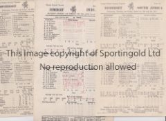
No Image Lot 896 SOMERSET C.C.C. Over 110 home and away scorecards, 82 from the 1950's including v Australia 1953 and 896SOMERSET C.C.C. Over 110 home and away scorecards, 82 from the 1950's including v Australia 1953 and Sportingold Limited SOMERSET C.C.C. Over 110 home and away scorecards, 82 from the 1950's including v Australia 1953 and 1956, Pakistan 1954, India 1959, West I... Live
No Image Lot 1266 FRANK WORTHINGTON Autographed 12 x 8 col photo of Worthington in full length action for the Tampa 1266FRANK WORTHINGTON Autographed 12 x 8 col photo of Worthington in full length action for the Tampa Sportingold Limited FRANK WORTHINGTON Autographed 12 x 8 col photo of Worthington in full length action for the Tampa Bay Rowdies, c1981, signed All The Best in ... Live
No Image Lot 1123 Nine 1923 OS 1/2500 maps of Northumberland, sheets NXXI 14, NXXII 16; NXXIII 7, 12, 14 & 15; NLIX 12 1123Nine 1923 OS 1/2500 maps of Northumberland, sheets NXXI 14, NXXII 16; NXXIII 7, 12, 14 & 15; NLIX 12 Railtons Nine 1923 OS 1/2500 maps of Northumberland, sheets NXXI 14, NXXII 16; NXXIII 7, 12, 14 & 15; NLIX 12 & 16; and NLXI 10 - Embleton Bay, Morpeth, St... Add to watchlist Live
No Image Lot 1225 A collection of C19th & C20th folding maps & atlases - FW Delkeskamp 1837 engraved panorama of the 1225A collection of C19th & C20th folding maps & atlases - FW Delkeskamp 1837 engraved panorama of the Railtons A collection of C19th & C20th folding maps & atlases - FW Delkeskamp 1837 engraved panorama of the Rhine, an Edwardian Geographia map of southern ... Add to watchlist Live
No Image Lot 394 An East London Bus map on board, dated April 1984, 25 1/4 x 40 1/2". 394An East London Bus map on board, dated April 1984, 25 1/4 x 40 1/2". Richard Edmonds Auctions An East London Bus map on board, dated April 1984, 25 1/4 x 40 1/2". Add to watchlist Live
No Image Lot 448 A heavy cast iron plate numbered 1981 - of railway, locomotive, wagon interest plus 448A heavy cast iron plate numbered 1981 - of railway, locomotive, wagon interest plus Richard Edmonds Auctions A heavy cast iron plate numbered 1981 - of railway, locomotive, wagon interest, 12 1/4 x 8" and a diagram map of the Great Western Railway, 22 x 1... Add to watchlist Live
No Image Lot 359 A map of Wiltshire by Robert Morden, circa 1695, sold by Abel Swale Awnsham, and John Churchill, 359A map of Wiltshire by Robert Morden, circa 1695, sold by Abel Swale Awnsham, and John Churchill, Batemans of Stamford A map of Wiltshire by Robert Morden, circa 1695, sold by Abel Swale Awnsham, and John Churchill, hand colored, framed, 35 by 42cm, mounted, glazed... Add to watchlist Live
No Image Lot 360 A large framed vintage print of the Saint-Emilion vineyard in France, 54 by 130cm. 360A large framed vintage print of the Saint-Emilion vineyard in France, 54 by 130cm. Batemans of Stamford A large framed vintage print of the Saint-Emilion vineyard in France, 54 by 130cm. Add to watchlist Live
No Image Lot 371 A Saxton/Kip map of Leicestershire (Lecesteriae), plus two more modern maps by Spede of Leicester, 371A Saxton/Kip map of Leicestershire (Lecesteriae), plus two more modern maps by Spede of Leicester, Batemans of Stamford A Saxton/Kip map of Leicestershire (Lecesteriae), plus two more modern maps by Spede of Leicester, framed. (3) Add to watchlist Live
No Image Lot 405 A Sea print titled ' things at the sea' by Paul Nesbitt [45x55.5cm] 405A Sea print titled ' things at the sea' by Paul Nesbitt [45x55.5cm] Three Bridges Auction House A Sea print titled ' things at the sea' by Paul Nesbitt [45x55.5cm] Add to watchlist Live
No Image Lot 417 Collection of early 20th Century Ordnance survey maps mostly of west country interest and dating 417Collection of early 20th Century Ordnance survey maps mostly of west country interest and dating Wessex Auction Rooms Collection of early 20th Century Ordnance survey maps mostly of west country interest and dating from the early 20th Century . Add to watchlist Live
No Image Lot 419 Collection of assorted mid Century folding maps of different areas of the UK to include Ordnance 419Collection of assorted mid Century folding maps of different areas of the UK to include Ordnance Wessex Auction Rooms Collection of assorted mid Century folding maps of different areas of the UK to include Ordnance survey one inch maps, Bartholomew's, Georgraphica... Add to watchlist Live
No Image Lot 517 A Box of British ordnance survey maps 517A Box of British ordnance survey maps Three Bridges Auction House A Box of British ordnance survey maps Add to watchlist Live
No Image Lot 518 A Box of British ordnance survey maps 518A Box of British ordnance survey maps Three Bridges Auction House A Box of British ordnance survey maps Add to watchlist Live
No Image Lot 5508 Cage containing Wallace and Gromit ornaments, plus mineral examples 5508Cage containing Wallace and Gromit ornaments, plus mineral examples W&H Peacock Auctioneers & Valuers Cage containing Wallace and Gromit ornaments, plus mineral examples Add to watchlist Live
No Image Lot 700 An 18th century page for Magna Britannia describing the County of Essex, framed and glazed. 700An 18th century page for Magna Britannia describing the County of Essex, framed and glazed. Rowley's Fine Art Auctioneers & Valuers An 18th century page for Magna Britannia describing the County of Essex, framed and glazed. 15 x 19 cm. Add to watchlist Live
No Image Lot 745 An 1818 Langley's new map of Norfolk, framed and glazed. 27.5 cm x 20.5 cm. 745An 1818 Langley's new map of Norfolk, framed and glazed. 27.5 cm x 20.5 cm. Rowley's Fine Art Auctioneers & Valuers An 1818 Langley's new map of Norfolk, framed and glazed. 27.5 cm x 20.5 cm. Add to watchlist Live
No Image Lot 1611 A world globe on stand 1611A world globe on stand Unique Auctions A world globe on stand Add to watchlist Live
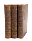
Reserve not met No Image Lot 21 BRICE, Germain. Description de la Ville 21BRICE, Germain. Description de la Ville Bearnes Hampton & Littlewood BRICE, Germain. Description de la Ville de Paris et de Tout ce Qu'elle contient de plus remarquable..., Sixie'me Edition., Paris: Francois Fournie... Add to watchlist Timed
Reserve not met No Image Lot 451 After Joshua Archer (1792-1863, British), a hand coloured map of Devonshire, framed, mounted, and 451After Joshua Archer (1792-1863, British), a hand coloured map of Devonshire, framed, mounted, and 1818 Auctioneers After Joshua Archer (1792-1863, British), a hand coloured map of Devonshire, framed, mounted, and under glass, measuring 19cm x 23cm, & 35cm x 38c... Add to watchlist Timed
Reserve not met No Image Lot 38 SANTINI, Paolo. Nouvelle Carte De L'Etat 38SANTINI, Paolo. Nouvelle Carte De L'Etat Bearnes Hampton & Littlewood SANTINI, Paolo. Nouvelle Carte De L'Etat De L'Eglise, Dressée sur Celle Du P. Boscovich, engraved map of Rome and district, title contained within... Add to watchlist Timed
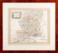
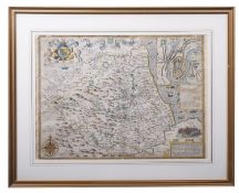
Reserve not met No Image Lot 39 MORDEN, Robert. Hampshire, hand coloured 39MORDEN, Robert. Hampshire, hand coloured Bearnes Hampton & Littlewood MORDEN, Robert. Hampshire, hand coloured map, in an attractive modern frame, good colouring, 42cm x 37cm. Add to watchlist Timed
Reserve not met No Image Lot 40 SHARPE, John (publisher). [Sharpe's Corr 40SHARPE, John (publisher). [Sharpe's Corr Bearnes Hampton & Littlewood SHARPE, John (publisher). [Sharpe's Corresponding Atlas], Chapman & Hall circa 1847, lacking title and preliminaries, 19 maps (only, of 54), some ... Add to watchlist Timed
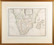
Reserve not met No Image Lot 42 SOUTHERN AFRICA. SANSON, Nicholas. Basse 42SOUTHERN AFRICA. SANSON, Nicholas. Basse Bearnes Hampton & Littlewood SOUTHERN AFRICA. SANSON, Nicholas. Basse Aethiopie, Paris 1655, a hand coloured engraved map, draped title cartouche, creases, crinkles, cropped, ... Add to watchlist Timed
Reserve not met No Image Lot 43 DURHAM, The Bishoprieke and Citie of Dur 43DURHAM, The Bishoprieke and Citie of Dur Bearnes Hampton & Littlewood DURHAM, The Bishoprieke and Citie of Durham. Hand coloured map, by John Speed, attractively f&g, circa 1610, with English text in the verso, 37.5c... Add to watchlist Timed
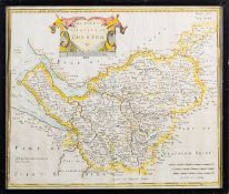
Reserve not met No Image Lot 45 MORDEN, Robert. The County Palatine of C 45MORDEN, Robert. The County Palatine of C Bearnes Hampton & Littlewood MORDEN, Robert. The County Palatine of Chester,1695 or later, hand coloured engraved map, some discolouration, 35cm x 42cm. Add to watchlist Timed
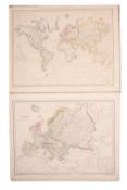
Reserve not met No Image Lot 306 Eight mid century canvas backed wall maps. This item carries VAT. 306Eight mid century canvas backed wall maps. This item carries VAT. Thimbleby & Shorland Eight mid century canvas backed wall maps, Europe; the World; England & Wales; N. America; S. America; Asia; Africa; Palestine. Estimate: £20-40. ... Add to watchlist Timed
Reserve not met No Image Lot 817 A collection of 22 Ordnance Survey WWII C.1940 Great Britain Maps 817A collection of 22 Ordnance Survey WWII C.1940 Great Britain Maps 1818 Auctioneers A collection of 22 Ordnance Survey WWII C.1940 Great Britain Maps Add to watchlist Timed
No Image Lot 189 A quantity of pictures, map and similar 189A quantity of pictures, map and similar Pump House Specialist Auctions Ltd A quantity of pictures, map and similar Add to watchlist Live
No Image Lot 309 A set of vintage maps, 309A set of vintage maps, Pump House Specialist Auctions Ltd A set of vintage maps, Add to watchlist Live
No Image Lot 321 A selection of vintage pictures and maps one depicting Russia in Asia 321A selection of vintage pictures and maps one depicting Russia in Asia Pump House Specialist Auctions Ltd A selection of vintage pictures and maps one depicting Russia in Asia Add to watchlist Live
No Image Lot 408 An antique map of Hertfordshire and two other reproduction maps 408An antique map of Hertfordshire and two other reproduction maps Pump House Specialist Auctions Ltd An antique map of Hertfordshire and two other reproduction maps Add to watchlist Live
No Image Lot 539 FIVE BOXES OF MIXED SUNDRIES to include an extensive array of 1930s Ordnance Survey Road Maps of the 539FIVE BOXES OF MIXED SUNDRIES to include an extensive array of 1930s Ordnance Survey Road Maps of the Richard Winterton Auctioneers FIVE BOXES OF MIXED SUNDRIES to include an extensive array of 1930s Ordnance Survey Road Maps of the Midlands, South of England, and Wales, a smal... Add to watchlist Live
No Image Lot 1250 A mid century German educational world map 1250A mid century German educational world map Gorringes A mid century German educational world map Add to watchlist Live
No Image Lot 1733 After Johannes Blaeu (Dutch, 1596-1673), hand coloured engraved map ‘’Surria vernacule Surrey’’, 1733After Johannes Blaeu (Dutch, 1596-1673), hand coloured engraved map ‘’Surria vernacule Surrey’’, Gorringes After Johannes Blaeu (Dutch, 1596-1673), hand coloured engraved map ‘’Surria vernacule Surrey’’, text verso, 38 x 48.5cm Add to watchlist Live
No Image Lot 1788 William Darton (1755-1819), folding hand coloured map, New and Correct Plan of London and 1788William Darton (1755-1819), folding hand coloured map, New and Correct Plan of London and Gorringes William Darton (1755-1819), folding hand coloured map, New and Correct Plan of London and Westminster with the Latest Improvements, publ. 1814, Wi... Add to watchlist Live
No Image Lot 31 A framed and glazed hand coloured map of Lincoln, 31A framed and glazed hand coloured map of Lincoln, Clarke and Simpson Auctions A framed and glazed hand coloured map of Lincoln, Derby, Stafford, Nottingham, Leicester, Norfolk Add to watchlist Live
No Image Lot 32 Robert Morden, hand coloured map of Scotland 32Robert Morden, hand coloured map of Scotland Clarke and Simpson Auctions Robert Morden, hand coloured map of Scotland Add to watchlist Live
No Image Lot 33 A hand coloured map of the road from London to Fla 33A hand coloured map of the road from London to Fla Clarke and Simpson Auctions A hand coloured map of the road from London to Flambrugh Add to watchlist Live
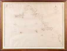
No Image Lot 91 A War Office Dept. folding map, Ordnance Survey Of 91A War Office Dept. folding map, Ordnance Survey Of Clarke and Simpson Auctions A War Office Dept. folding map, Ordnance Survey Office Southampton, dated 8th May 1871 Add to watchlist Live
No Image Lot 256 Coloured map of North Norfolk, framed and glazed 256Coloured map of North Norfolk, framed and glazed Keys Fine Art Auctioneers Coloured map of North Norfolk, framed and glazed Add to watchlist Live
No Image Lot 306 A world globe on stand 306A world globe on stand Clarke and Simpson Auctions A world globe on stand Add to watchlist Live
No Image Lot 335 A map of The Liverpool Overhead Railway, Principle 335A map of The Liverpool Overhead Railway, Principle Clarke and Simpson Auctions A map of The Liverpool Overhead Railway, Principle Buildings and the Famous Docks Add to watchlist Live
No Image Lot 342 Coloured print, "East Coast Types" 342Coloured print, "East Coast Types" Clarke and Simpson Auctions Coloured print, "East Coast Types" Add to watchlist Live
No Image Lot 515 A framed and glazed map and various rolled maps, n 515A framed and glazed map and various rolled maps, n Clarke and Simpson Auctions A framed and glazed map and various rolled maps, newspapers etc. Add to watchlist Live
No Image Lot 521 A large framed coloured print of a river scene 521A large framed coloured print of a river scene Clarke and Simpson Auctions A large framed coloured print of a river scene Add to watchlist Live
No Image Lot 731 A large quantity of artists colouring pencils 731A large quantity of artists colouring pencils Clarke and Simpson Auctions A large quantity of artists colouring pencils Add to watchlist Live
No Image Lot 732 A large quantity of artists colouring pencils 732A large quantity of artists colouring pencils Clarke and Simpson Auctions A large quantity of artists colouring pencils Add to watchlist Live
No Image Lot 758 A quantity of jumbo sized colouring pencils 758A quantity of jumbo sized colouring pencils Clarke and Simpson Auctions A quantity of jumbo sized colouring pencils Add to watchlist Live
No Image Lot 759 A quantity of jumbo sized colouring pencils 759A quantity of jumbo sized colouring pencils Clarke and Simpson Auctions A quantity of jumbo sized colouring pencils Add to watchlist Live
No Image Lot 785 Four boxes of miscellaneous books, maps etc. 785Four boxes of miscellaneous books, maps etc. Clarke and Simpson Auctions Four boxes of miscellaneous books, maps etc. Add to watchlist Live
No Image Lot 786 A box of miscellaneous maps etc. 786A box of miscellaneous maps etc. Clarke and Simpson Auctions A box of miscellaneous maps etc. Add to watchlist Live
No Image Lot 904 A box of miscellaneous maps, games etc. 904A box of miscellaneous maps, games etc. Clarke and Simpson Auctions A box of miscellaneous maps, games etc. Add to watchlist Live
No Image Lot 945 A quantity of various prints, maps etc. 945A quantity of various prints, maps etc. Clarke and Simpson Auctions A quantity of various prints, maps etc. Add to watchlist Live
No Image Lot 945 Vietnam War Era US Compass Dated 1965 & Jungle Map. 945Vietnam War Era US Compass Dated 1965 & Jungle Map. Cadmore Auctions Ltd Vietnam War Era US Compass Dated 1965 & Jungle Map. Add to watchlist Live
No Image Lot 1136 A collection of various unframed maps 1136A collection of various unframed maps Clarke and Simpson Auctions A collection of various unframed maps Add to watchlist Live
No Image Lot 1202G A collection of World War II Ordnance Survey maps, maps of parts of Malaya, Singapore and Jahore, 1202GA collection of World War II Ordnance Survey maps, maps of parts of Malaya, Singapore and Jahore, Piers Motley Auctions A collection of World War II Ordnance Survey maps, maps of parts of Malaya, Singapore and Jahore, together with some 1946 newspapers. Add to watchlist Live
No Image Lot 1211 A soil leveller 1211A soil leveller Clarke and Simpson Auctions A soil leveller Add to watchlist Live
No Image Lot 1354 A reproduction map of The American Southeast in 1606, F & G, 44 x 56cm 1354A reproduction map of The American Southeast in 1606, F & G, 44 x 56cm Piers Motley Auctions A reproduction map of The American Southeast in 1606, F & G, 44 x 56cm Add to watchlist Live


![A Sea print titled ' things at the sea' by Paul Nesbitt [45x55.5cm]](https://portal-images.azureedge.net/auctions-2024/three-10000/images/a78db6a0-d238-4ee7-8364-b17e00fecc53.jpg?h=175)